
Charsznica topographic map
Interactive map
Click on the map to display elevation.
About this map
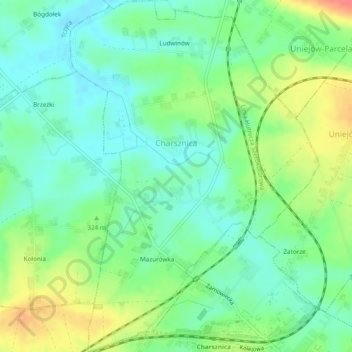
Name: Charsznica topographic map, elevation, terrain.
Average elevation: 320 m
Minimum elevation: 298 m
Maximum elevation: 361 m
Other topographic maps
Click on a map to view its topography, its elevation and its terrain.
Miechów
Poland > Lesser Poland Voivodeship > powiat miechowski
Miechów, gmina Miechów, powiat miechowski, Lesser Poland Voivodeship, Poland
Average elevation: 311 m