
Carara topographic map
Interactive map
Click on the map to display elevation.
About this map
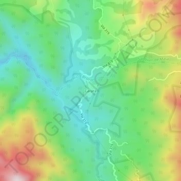
Name: Carara topographic map, elevation, terrain.
Average elevation: 330 m
Minimum elevation: 116 m
Maximum elevation: 732 m
Other topographic maps
Click on a map to view its topography, its elevation and its terrain.
Tulín
Costa Rica > Cantón Turrubares > Carara
Tulín, Carara, Cantón Turrubares, San Jose Province, 11605, Costa Rica
Average elevation: 115 m