
Nürensdorf topographic map
Interactive map
Click on the map to display elevation.
About this map
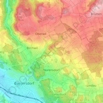
Name: Nürensdorf topographic map, elevation, terrain.
Location: Nürensdorf, Bezirk Bülach, Zürich, 8309, Schweiz (47.43512 8.62396 47.47894 8.67880)
Average elevation: 547 m
Minimum elevation: 448 m
Maximum elevation: 640 m
Die umliegenden Ortsteile und Weiler sind verhältnismässig weit gestreut: Ein Wald trennt die Teile Birchwil und Oberwil von Nürensdorfs Kern. Die Breite und Kleinhaus liegen über 100 Höhenmeter höher, ebenfalls abgetrennt durch Waldstücke.