
Matehuala topographic map
Interactive map
Click on the map to display elevation.
About this map
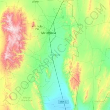
Name: Matehuala topographic map, elevation, terrain.
Location: Matehuala, San Luis Potosí, Mexico (23.21405 -100.78305 23.82926 -100.44570)
Average elevation: 1,819 m
Minimum elevation: 1,320 m
Maximum elevation: 3,144 m