
Saint-Jean topographic map
Interactive map
Click on the map to display elevation.
About this map
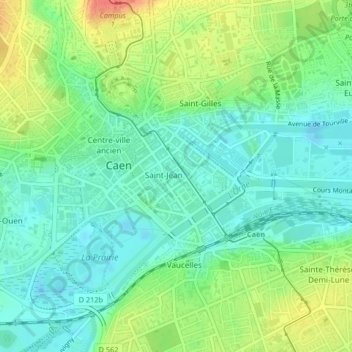
Name: Saint-Jean topographic map, elevation, terrain.
Average elevation: 20 m
Minimum elevation: -2 m
Maximum elevation: 56 m
Other topographic maps
Click on a map to view its topography, its elevation and its terrain.
Caen
Frankreich > Normandie > Caen
Caen, Calvados, Normandie, Metropolitanes Frankreich, 14000, Frankreich
Average elevation: 37 m