Geolocate

Walluf topographic map

Click on the map to display elevation.

About this map
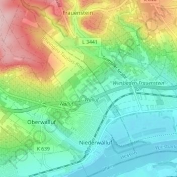
Name: Walluf topographic map, elevation, terrain.

Location: Walluf, Rheingau-Taunus-Kreis, Hesse, 65396, Germany (50.02981 8.12732 50.06881 8.17516)

Average elevation: 150 m

Minimum elevation: 79 m

Maximum elevation: 293 m

Gear up for your next adventure:

🍳Camping Stoves - Compact stoves for outdoor cooking
🧣Neck Gaiters - Protects against wind and sun on exposed ridges and peaks
🗺️Ordnance Survey Maps - Essential paper maps for hiking across the UK national parks
🛰️Outdoor GPS Navigation - Navigation devices for remote and off-grid areas
🧤Hiking Gloves - Warm and durable gloves for cold-weather walks

As an Amazon Associate, this site earns from qualifying purchases at no extra cost to you.