
Thank you for supporting this site ❤️
Make a donation
Make a donation
Gear up for your next adventure:
As an Amazon Associate, this site earns from qualifying purchases at no extra cost to you.
Sankoo topographic map
Click on the map to display elevation.
Thank you for supporting this site ❤️
Make a donation
Make a donation
Gear up for your next adventure:
As an Amazon Associate, this site earns from qualifying purchases at no extra cost to you.
About this map
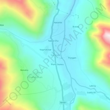
Name: Sankoo topographic map, elevation, terrain.
Location: Sankoo, Sankoo tehsil, Kargil district, Ladakh, India (34.26968 75.94222 34.30968 75.98222)
Average elevation: 3,149 m
Minimum elevation: 2,932 m
Maximum elevation: 3,799 m
Thank you for supporting this site ❤️
Make a donation
Make a donation
Gear up for your next adventure:
As an Amazon Associate, this site earns from qualifying purchases at no extra cost to you.