
Kuusamo topographic map
Interactive map
Click on the map to display elevation.
Kuusamo
The city lies on a roughly 250-meter-high plateau, from which the waters flow in five directions. In the area of Kuusamo there are many hills (Finn. vaara) and fells (Finn. tunturi). The highest elevations are Valtavaara (492 m), Kuntivaara (481 m), Iivaara (469 m) and Rukatunturi (492 m), the site of the Ruka ski center.
About this map
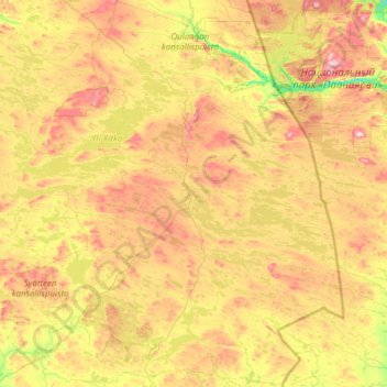
Name: Kuusamo topographic map, elevation, terrain.
Average elevation: 266 m
Minimum elevation: 119 m
Maximum elevation: 563 m
Other topographic maps
Click on a map to view its topography, its elevation and its terrain.