
El Cordon topographic map
Interactive map
Click on the map to display elevation.
About this map
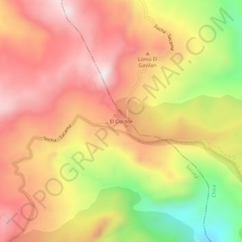
Name: El Cordon topographic map, elevation, terrain.
Average elevation: 3,521 m
Minimum elevation: 3,118 m
Maximum elevation: 3,794 m
Other topographic maps
Click on a map to view its topography, its elevation and its terrain.
Río Arzobispo
Colombia > Boyacá > Socotá > Los Pinos
Río Arzobispo, Los Pinos, Socotá, Valderrama, Boyacá, RAP (Especial) Central, Colombia
Average elevation: 3,467 m