
Maple Falls topographic map
Interactive map
Click on the map to display elevation.
About this map
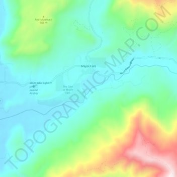
Name: Maple Falls topographic map, elevation, terrain.
Average elevation: 442 m
Minimum elevation: 122 m
Maximum elevation: 1,419 m
Other topographic maps
Click on a map to view its topography, its elevation and its terrain.
Bellingham
États-Unis d'Amérique > Washington > Whatcom County > Bellingham
Bellingham, Whatcom County, Washington, 98225-3243, États-Unis d'Amérique
Average elevation: 129 m
Bellingham
États-Unis d'Amérique > Washington > Whatcom County
Bellingham, Whatcom County, Washington, États-Unis d'Amérique
Average elevation: 89 m