
Corsano topographic map
Interactive map
Click on the map to display elevation.
About this map
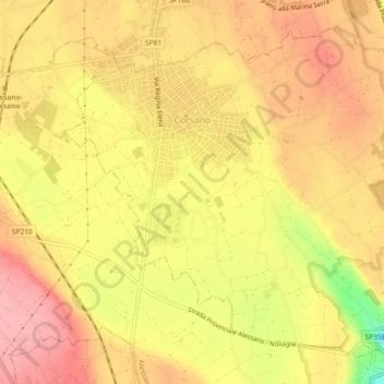
Name: Corsano topographic map, elevation, terrain.
Location: Corsano, Lecce, Pouilles, 73033, Italie (39.86744 18.35406 39.89779 18.39964)
Average elevation: 124 m
Minimum elevation: 41 m
Maximum elevation: 168 m
Other topographic maps
Click on a map to view its topography, its elevation and its terrain.
Baia dei Turchi
Italie > Pouilles > Lecce > Otranto
Baia dei Turchi, Otranto, Lecce, Pouilles, Italie
Average elevation: 4 m
Presicce-Acquarica
Presicce-Acquarica, Lecce, Pouilles, Italie
Average elevation: 123 m