
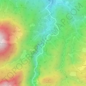
Alplochschlucht topographic map
Interactive map
Click on the map to display elevation.
About this map
Name: Alplochschlucht topographic map, elevation, terrain.
Average elevation: 874 m
Minimum elevation: 518 m
Maximum elevation: 1,419 m
Other topographic maps
Click on a map to view its topography, its elevation and its terrain.
Dornbirn
Österreich > Vorarlberg > Dornbirn
Dornbirn, Bezirk Dornbirn, Vorarlberg, 6850, Österreich
Average elevation: 574 m
Dornbirner Ach
Österreich > Vorarlberg > Dornbirn
Dornbirner Ach, Dornbirn, Vorarlberg, 6850, Österreich
Average elevation: 990 m