
Dörnberg topographic map
Interactive map
Click on the map to display elevation.
About this map
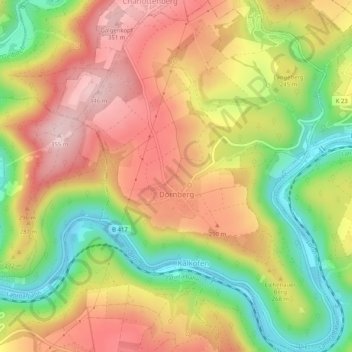
Name: Dörnberg topographic map, elevation, terrain.
Average elevation: 230 m
Minimum elevation: 89 m
Maximum elevation: 355 m
Other topographic maps
Click on a map to view its topography, its elevation and its terrain.
Siedlung Loreley
Deutschland > Rheinland-Pfalz > Rhein-Lahn-Kreis > Bornich
Siedlung Loreley, Bornich, Loreley, Rhein-Lahn-Kreis, Rheinland-Pfalz, 56329, Deutschland
Average elevation: 221 m