
Thank you for supporting this site ❤️
Make a donation
Make a donation
Gear up for your next adventure:
As an Amazon Associate, this site earns from qualifying purchases at no extra cost to you.
Uchucubamba topographic map
Click on the map to display elevation.
Thank you for supporting this site ❤️
Make a donation
Make a donation
Gear up for your next adventure:
As an Amazon Associate, this site earns from qualifying purchases at no extra cost to you.
About this map
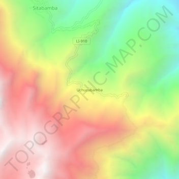
Name: Uchucubamba topographic map, elevation, terrain.
Location: Uchucubamba, Sitabamba, Santiago de Chuco, La Libertad, Perú (-8.06072 -77.74014 -8.02072 -77.70014)
Average elevation: 3,449 m
Minimum elevation: 2,569 m
Maximum elevation: 4,276 m
Thank you for supporting this site ❤️
Make a donation
Make a donation
Gear up for your next adventure:
As an Amazon Associate, this site earns from qualifying purchases at no extra cost to you.