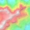
Leuggelbach topographic map
Click on the map to display elevation.
Leuggelbach
Leuggelbach is located in the valley of the Linth river, with the village situated on the west bank of the river at an elevation of approximately 554 m (1,818 ft). Luchsingen lies to the south, Nidfurn is to the north, and Haslen is across the river to the north and east.
About this map

Name: Leuggelbach topographic map, elevation, terrain.
Location: Leuggelbach, Glarus Süd, Glarus, 8775, Switzerland (46.95737 9.02583 46.99737 9.06583)
Average elevation: 990 m
Minimum elevation: 518 m
Maximum elevation: 2,164 m
Other topographic maps
Click on a map to view its topography, its elevation and its terrain.