Geolocate

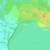
Turawa topographic map

Click on the map to display elevation.

About this map

Name: Turawa topographic map, elevation, terrain.

Location: Turawa, gmina Turawa, Opole County, Opole Voivodeship, 46-045, Poland (50.69993 18.04886 50.78138 18.19039)

Average elevation: 173 m

Minimum elevation: 153 m

Maximum elevation: 210 m

Other topographic maps

Click on a map to view its topography, its elevation and its terrain.
Rybaczówka

Poland > Opole Voivodeship > Opole County > Turawa

Average elevation: 175 m

Gear up for your next adventure:

🧼Biodegradable Soap - Leave-no-trace hygiene for multi-day mountain treks
🪓Outdoor Multitools - Versatile tools for hiking and camping
🧤Hiking Gloves - Warm and durable gloves for cold-weather walks
🌄Outdoor Binoculars - Compact binoculars for landscape observation
🦟Anti-Midge & Tick Repellent - Vital for hiking in the Scottish Highlands during summer

As an Amazon Associate, this site earns from qualifying purchases at no extra cost to you.