Geolocate

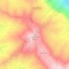
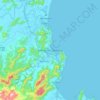
Laguna topographic map

Click on the map to display elevation.

Laguna

Laguna is a Brazilian municipality located in the southern state of Santa Catarina, 120 kilometers south of the state's capital, Florianópolis, and north east of Porto Alegre. The population is 46,122 (2020 est.) in an area of 336.4 km2. The elevation is 2 m. The BR-101 coastal highway passes through the municipality.

Wikipedia (CC-BY-SA 3.0)

About this map

Name: Laguna topographic map, elevation, terrain.

Location: Laguna, Santa Catarina, South Region, Brazil (-28.61577 -48.94396 -28.32486 -48.70606)

Average elevation: 11 m

Minimum elevation: -5 m

Maximum elevation: 414 m

Other topographic maps

Click on a map to view its topography, its elevation and its terrain.
Três Picos

Brazil > Santa Catarina

Average elevation: 795 m

Residência Fuck

Brazil > Santa Catarina > Monte Castelo

Average elevation: 845 m

Córrego do Fuck

Brazil > Santa Catarina > Canoinhas

Average elevation: 786 m

Serra da Bateia

Brazil > Santa Catarina > Guabiruba

Average elevation: 339 m

Alto Pitanga

Brazil > Santa Catarina > Nova Trento

Average elevation: 427 m

Palhocinha

Brazil > Santa Catarina > Trombudo Central

Average elevation: 391 m

Pericó

Brazil > Santa Catarina > São Joaquim

Average elevation: 1,239 m

Gear up for your next adventure:

👕Technical Hiking Tees - Moisture-management for high-exertion climbs
🧭GPS Trackers - Tracking devices for safety and navigation
🥾Trekking Poles - Poles to improve stability on uneven terrain
🗺️Ordnance Survey Maps - Essential paper maps for hiking across the UK national parks
🧺Mesh Stuff Sacks - Breathable storage for wet gear or camp organization

As an Amazon Associate, this site earns from qualifying purchases at no extra cost to you.