
Provincia de Iquique topographic map
Interactive map
Click on the map to display elevation.
About this map
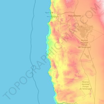
Name: Provincia de Iquique topographic map, elevation, terrain.
Location: Provincia de Iquique, Región de Tarapacá, Chile (-21.43896 -70.20976 -20.04860 -69.81961)
Average elevation: 496 m
Minimum elevation: 0 m
Maximum elevation: 2,168 m
Other topographic maps
Click on a map to view its topography, its elevation and its terrain.
Pica
Chile > Región de Tarapacá > Pica
Pica, Provincia del Tamarugal, Región de Tarapacá, Chile
Average elevation: 2,300 m