
Malaita topographic map
Interactive map
Click on the map to display elevation.
About this map
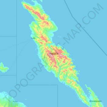
Name: Malaita topographic map, elevation, terrain.
Location: Malaita, Solomon Islands (-9.59809 160.55900 -8.31227 161.41064)
Average elevation: 53 m
Minimum elevation: -2 m
Maximum elevation: 1,262 m
Other topographic maps
Click on a map to view its topography, its elevation and its terrain.