
Moscow Canal Lock №11 topographic map
Interactive map
Click on the map to display elevation.
About this map
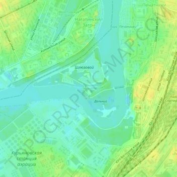
Name: Moscow Canal Lock №11 topographic map, elevation, terrain.
Average elevation: 123 m
Minimum elevation: 113 m
Maximum elevation: 137 m
Other topographic maps
Click on a map to view its topography, its elevation and its terrain.
Парк имени 1 мая
Парк имени 1 мая, Lefortovo District, Moscow, Central Federal District, Russia
Average elevation: 142 m
"Золотая миля"
"Золотая миля", Khamovniki District, Moscow, Central Federal District, 119034, Russia
Average elevation: 135 m