Geolocate

Golfar topographic map

Click on the map to display elevation.

About this map
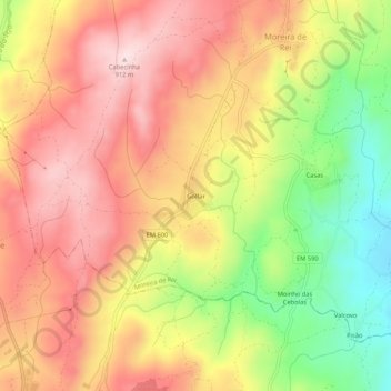
Name: Golfar topographic map, elevation, terrain.

Location: Golfar, Moreira de Rei, Trancoso, Guarda, 6420-153, Portugal (40.79469 -7.35366 40.83469 -7.31366)

Average elevation: 762 m

Minimum elevation: 564 m

Maximum elevation: 909 m

Gear up for your next adventure:

🦯Walking Poles - Supportive poles for long-distance walking
📸Action Camera Chest Mounts - Record your ascent following topographic paths hands-free
🧥Packable Down Jackets - Lightweight warmth that compresses small in your bag
🚶Walking Pedometers - Simple distance tracking for casual trail walkers
🔋Power Banks - Portable chargers for long outdoor trips

As an Amazon Associate, this site earns from qualifying purchases at no extra cost to you.