
Thank you for supporting this site ❤️
Make a donation
Make a donation
Gear up for your next adventure:
As an Amazon Associate, this site earns from qualifying purchases at no extra cost to you.
Teotihuacán topographic map
Click on the map to display elevation.
Thank you for supporting this site ❤️
Make a donation
Make a donation
Gear up for your next adventure:
As an Amazon Associate, this site earns from qualifying purchases at no extra cost to you.
About this map
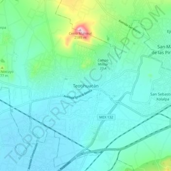
Name: Teotihuacán topographic map, elevation, terrain.
Location: Teotihuacán, State of Mexico, 55816, Mexico (19.64753 -98.91574 19.72753 -98.83574)
Average elevation: 2,311 m
Minimum elevation: 2,254 m
Maximum elevation: 2,592 m
Thank you for supporting this site ❤️
Make a donation
Make a donation
Gear up for your next adventure:
As an Amazon Associate, this site earns from qualifying purchases at no extra cost to you.