
Thank you for supporting this site ❤️
Make a donation
Make a donation
Gear up for your next adventure:
As an Amazon Associate, this site earns from qualifying purchases at no extra cost to you.
Lamas topographic map
Click on the map to display elevation.
Thank you for supporting this site ❤️
Make a donation
Make a donation
Gear up for your next adventure:
As an Amazon Associate, this site earns from qualifying purchases at no extra cost to you.
About this map
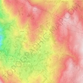
Name: Lamas topographic map, elevation, terrain.
Location: Lamas, Alvadia, Ribeira de Pena, Vila Real, Portugal (41.43230 -7.78025 41.47230 -7.74025)
Average elevation: 1,025 m
Minimum elevation: 737 m
Maximum elevation: 1,180 m
Thank you for supporting this site ❤️
Make a donation
Make a donation
Gear up for your next adventure:
As an Amazon Associate, this site earns from qualifying purchases at no extra cost to you.