
Romansleigh topographic map
Interactive map
Click on the map to display elevation.
About this map
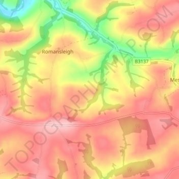
Name: Romansleigh topographic map, elevation, terrain.
Location: Romansleigh, North Devon, Devon, England, United Kingdom (50.94365 -3.83451 50.97904 -3.76902)
Average elevation: 171 m
Minimum elevation: 72 m
Maximum elevation: 230 m
Devon trails, hiking, mountain biking, running and outdoor activities
Other topographic maps
Click on a map to view its topography, its elevation and its terrain.