
Thank you for supporting this site ❤️
Make a donation
Make a donation
Gear up for your next adventure:
As an Amazon Associate, this site earns from qualifying purchases at no extra cost to you.
Nkoabang topographic map
Click on the map to display elevation.
Thank you for supporting this site ❤️
Make a donation
Make a donation
Gear up for your next adventure:
As an Amazon Associate, this site earns from qualifying purchases at no extra cost to you.
About this map
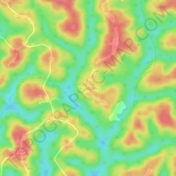
Name: Nkoabang topographic map, elevation, terrain.
Location: Nkoabang, Mbankomo, Méfou-et-Akono, Région du Centre, Cameroun (3.64257 11.40163 3.68257 11.44163)
Average elevation: 705 m
Minimum elevation: 667 m
Maximum elevation: 743 m
Thank you for supporting this site ❤️
Make a donation
Make a donation
Gear up for your next adventure:
As an Amazon Associate, this site earns from qualifying purchases at no extra cost to you.