
West Lake Hills topographic map
Interactive map
Click on the map to display elevation.
About this map
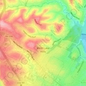
Name: West Lake Hills topographic map, elevation, terrain.
Location: West Lake Hills, Travis County, Texas, 78746, United States (30.27310 -97.82840 30.30794 -97.78731)
Average elevation: 228 m
Minimum elevation: 133 m
Maximum elevation: 307 m