
San Antolín de Ibias topographic map
Interactive map
Click on the map to display elevation.
About this map
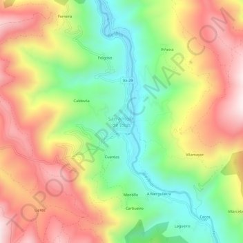
Name: San Antolín de Ibias topographic map, elevation, terrain.
Location: San Antolín de Ibias, Ibias, Asturias, España (43.01863 -6.89239 43.05863 -6.85239)
Average elevation: 550 m
Minimum elevation: 245 m
Maximum elevation: 884 m
Other topographic maps
Click on a map to view its topography, its elevation and its terrain.