Geolocate

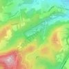
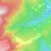
Queens Domain topographic map

Click on the map to display elevation.

About this map

Name: Queens Domain topographic map, elevation, terrain.

Location: Queens Domain, Hobart, City of Hobart, Tasmania, Australia (-42.87843 147.31468 -42.85599 147.33947)

Average elevation: 48 m

Minimum elevation: -2 m

Maximum elevation: 194 m

Other topographic maps

Click on a map to view its topography, its elevation and its terrain.
Selfs Point

Australia > Tasmania > Hobart

Average elevation: 17 m

Waterworks Reserve

Australia > Tasmania > Hobart

Average elevation: 240 m

James Austin Park

Australia > Tasmania > Hobart

Average elevation: 25 m

Glenrose Park

Australia > Tasmania > Hobart

Average elevation: 181 m

Flagstaff Hill

Australia > Tasmania > Hobart

Average elevation: 204 m

Perrins Ridge

Australia > Tasmania > Hobart

Average elevation: 467 m

Cartwright Point

Australia > Tasmania > Hobart

Average elevation: 59 m

Mount Direction

Australia > Tasmania > Hobart

Average elevation: 166 m

Glebe Hill

Australia > Tasmania > Hobart

Average elevation: 66 m

Knocklofty

Australia > Tasmania > Hobart

Average elevation: 185 m

Snug Falls

Australia > Tasmania > Hobart > Snug

Average elevation: 336 m

Tolosa Park

Australia > Tasmania > Hobart

Average elevation: 182 m

Single Hill Bush Reserve

Australia > Tasmania > Hobart

Average elevation: 34 m

Hinsby Beach

Australia > Tasmania > Hobart

Average elevation: 86 m

Gear up for your next adventure:

🖼️Topographic Map Art - Decorative 3D-effect posters of famous UK peaks and regions
🔥Reusable Hand Warmers - Maintain dexterity in your fingers for precise map handling
🧴Tick Removal Tools - Small, essential health tool for UK woodland and moorland
❄️Walking Crampons - Added traction for icy slopes and winter peak bagging
🗺️Scratch-off Peak Maps - Track your progress climbing Munros or Wainwrights

As an Amazon Associate, this site earns from qualifying purchases at no extra cost to you.