
Maasen topographic map
Interactive map
Click on the map to display elevation.
About this map
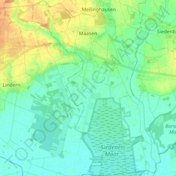
Name: Maasen topographic map, elevation, terrain.
Average elevation: 41 m
Minimum elevation: 31 m
Maximum elevation: 63 m
Other topographic maps
Click on a map to view its topography, its elevation and its terrain.
NSG Uchter Moor
Deutschland > Niedersachsen > Landkreis Diepholz > Wagenfeld
NSG Uchter Moor, Wagenfeld, Samtgemeinde Uchte, Landkreis Diepholz, Niedersachsen, Deutschland
Average elevation: 43 m