
Thank you for supporting this site ❤️
Make a donation
Make a donation
Gear up for your next adventure:
As an Amazon Associate, this site earns from qualifying purchases at no extra cost to you.
Hafjell topographic map
Click on the map to display elevation.
Thank you for supporting this site ❤️
Make a donation
Make a donation
Gear up for your next adventure:
As an Amazon Associate, this site earns from qualifying purchases at no extra cost to you.
About this map
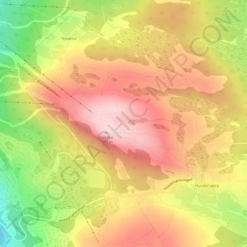
Name: Hafjell topographic map, elevation, terrain.
Location: Hafjell, Nysætra, Øyer, Innlandet, Norway (61.22734 10.51732 61.23390 10.53973)
Average elevation: 964 m
Minimum elevation: 816 m
Maximum elevation: 1,068 m
Thank you for supporting this site ❤️
Make a donation
Make a donation
Gear up for your next adventure:
As an Amazon Associate, this site earns from qualifying purchases at no extra cost to you.