
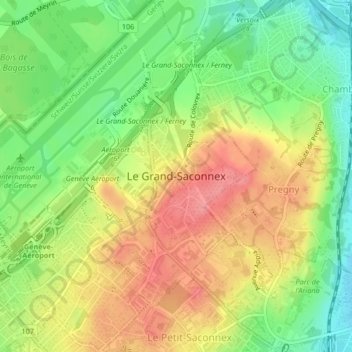
Le Grand-Saconnex topographic map
Interactive map
Click on the map to display elevation.
About this map
Name: Le Grand-Saconnex topographic map, elevation, terrain.
Location: Le Grand-Saconnex, Genève, 1218, Suisse (46.22193 6.10089 46.25065 6.13603)
Average elevation: 429 m
Minimum elevation: 386 m
Maximum elevation: 471 m
Other topographic maps
Click on a map to view its topography, its elevation and its terrain.
chemin de la ferme
chemin de la ferme, La Grande Coudre, Céligny, Genève, 1298, Suisse
Average elevation: 455 m
Le Grand-Saconnex
Suisse > Genève > Le Grand-Saconnex > Le Grand-Saconnex
Le Grand-Saconnex, Genève, 1218, Suisse
Average elevation: 414 m