
Montone topographic map
Interactive map
Click on the map to display elevation.
About this map
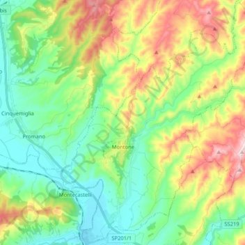
Name: Montone topographic map, elevation, terrain.
Location: Montone, Perugia, Umbria, 06014, Italia (43.31581 12.29050 43.43215 12.42405)
Average elevation: 403 m
Minimum elevation: 237 m
Maximum elevation: 731 m