
Ispringen topographic map
Interactive map
Click on the map to display elevation.
About this map
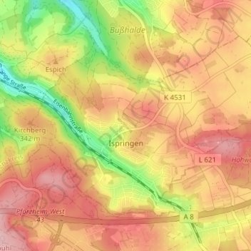
Name: Ispringen topographic map, elevation, terrain.
Location: Ispringen, Enzkreis, Baden-Württemberg, 75228, Deutschland (48.90875 8.64541 48.93788 8.70713)
Average elevation: 322 m
Minimum elevation: 223 m
Maximum elevation: 389 m
Other topographic maps
Click on a map to view its topography, its elevation and its terrain.
Keltern
Deutschland > Baden-Württemberg > Enzkreis
Keltern, Enzkreis, Baden-Württemberg, 75210, Deutschland
Average elevation: 285 m