
Thank you for supporting this site ❤️
Make a donation
Make a donation
Gear up for your next adventure:
As an Amazon Associate, this site earns from qualifying purchases at no extra cost to you.
Chambon topographic map
Click on the map to display elevation.
Thank you for supporting this site ❤️
Make a donation
Make a donation
Gear up for your next adventure:
As an Amazon Associate, this site earns from qualifying purchases at no extra cost to you.
About this map
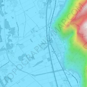
Name: Chambon topographic map, elevation, terrain.
Location: Chambon, Roche (VD), District d'Aigle, Vaud, 1852, Switzerland (46.34163 6.90037 46.38163 6.94037)
Average elevation: 485 m
Minimum elevation: 372 m
Maximum elevation: 1,377 m
Thank you for supporting this site ❤️
Make a donation
Make a donation
Gear up for your next adventure:
As an Amazon Associate, this site earns from qualifying purchases at no extra cost to you.