
Obersaxen-Misanenga topographic map
Interactive map
Click on the map to display elevation.
About this map
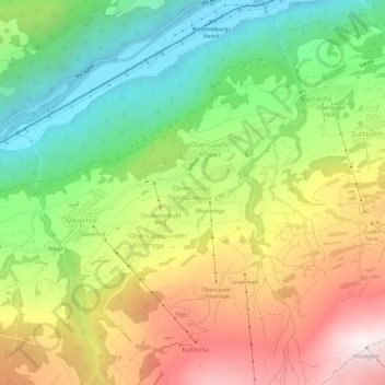
Name: Obersaxen-Misanenga topographic map, elevation, terrain.
Average elevation: 1,336 m
Minimum elevation: 735 m
Maximum elevation: 2,112 m
Other topographic maps
Click on a map to view its topography, its elevation and its terrain.
Surcuolm
Schweiz > Graubünden > Surselva > Obersaxen-Mundaun
Surcuolm, Obersaxen-Mundaun, Surselva, Graubünden, 7138, Schweiz
Average elevation: 1,311 m