
Thank you for supporting this site ❤️
Make a donation
Make a donation
Gear up for your next adventure:
As an Amazon Associate, this site earns from qualifying purchases at no extra cost to you.
Lopnur topographic map
Click on the map to display elevation.
Thank you for supporting this site ❤️
Make a donation
Make a donation
Gear up for your next adventure:
As an Amazon Associate, this site earns from qualifying purchases at no extra cost to you.
About this map
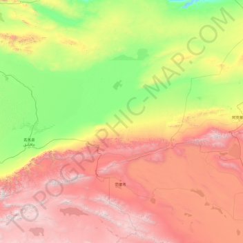
Name: Lopnur topographic map, elevation, terrain.
Location: Lopnur, Ruoqiang County, Bayingolin, Xinjiang, China (37.78371 86.68536 41.37673 93.81947)
Average elevation: 2,076 m
Minimum elevation: 549 m
Maximum elevation: 5,994 m
Thank you for supporting this site ❤️
Make a donation
Make a donation
Gear up for your next adventure:
As an Amazon Associate, this site earns from qualifying purchases at no extra cost to you.