
Finsterhennen topographic map
Interactive map
Click on the map to display elevation.
About this map
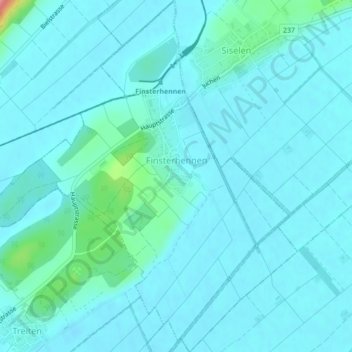
Name: Finsterhennen topographic map, elevation, terrain.
Average elevation: 445 m
Minimum elevation: 433 m
Maximum elevation: 539 m
Other topographic maps
Click on a map to view its topography, its elevation and its terrain.
Bargen (BE)
Schweiz > Bern > Verwaltungskreis Seeland
Bargen (BE), Verwaltungskreis Seeland, Verwaltungsregion Seeland, Bern, 3282, Schweiz
Average elevation: 474 m
Ins
Schweiz > Bern > Verwaltungskreis Seeland
Ins, Verwaltungskreis Seeland, Verwaltungsregion Seeland, Bern, 3232, Schweiz
Average elevation: 460 m
Erlach
Schweiz > Bern > Verwaltungskreis Seeland
Erlach, Verwaltungskreis Seeland, Verwaltungsregion Seeland, Bern, 3235, Schweiz
Average elevation: 464 m