
Startzville topographic map
Interactive map
Click on the map to display elevation.
About this map
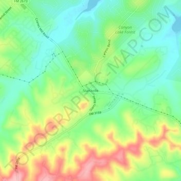
Name: Startzville topographic map, elevation, terrain.
Location: Startzville, Comal County, Texas, 79133, USA (29.82466 -98.29390 29.86466 -98.25390)
Average elevation: 333 m
Minimum elevation: 276 m
Maximum elevation: 426 m