
Thank you for supporting this site ❤️
Make a donation
Make a donation
Gear up for your next adventure:
As an Amazon Associate, this site earns from qualifying purchases at no extra cost to you.
Clanezzo topographic map
Click on the map to display elevation.
Thank you for supporting this site ❤️
Make a donation
Make a donation
Gear up for your next adventure:
As an Amazon Associate, this site earns from qualifying purchases at no extra cost to you.
About this map
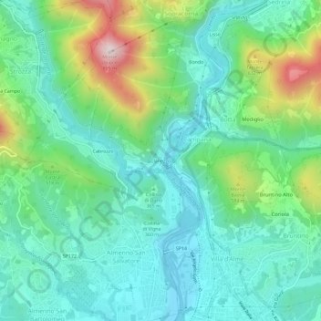
Name: Clanezzo topographic map, elevation, terrain.
Location: Clanezzo, Ubiale Clanezzo, Bergamo, Lombardy, 24010, Italy (45.74191 9.58252 45.78191 9.62252)
Average elevation: 401 m
Minimum elevation: 240 m
Maximum elevation: 858 m
Thank you for supporting this site ❤️
Make a donation
Make a donation
Gear up for your next adventure:
As an Amazon Associate, this site earns from qualifying purchases at no extra cost to you.