
Paya Jaras Dalam topographic map
Interactive map
Click on the map to display elevation.
About this map
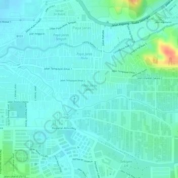
Name: Paya Jaras Dalam topographic map, elevation, terrain.
Location: Paya Jaras Dalam, Shah Alam, Petaling, Selangor, Malaysia (3.18672 101.53692 3.19399 101.55324)
Average elevation: 29 m
Minimum elevation: 18 m
Maximum elevation: 72 m
Other topographic maps
Click on a map to view its topography, its elevation and its terrain.
Kampung Baru Sungai Pelong
Malaysia > Selangor > Shah Alam > Sungai Buloh > Kampung Baru Sungai Pelong
Average elevation: 38 m