
Thank you for supporting this site ❤️
Make a donation
Make a donation
Gear up for your next adventure:
As an Amazon Associate, this site earns from qualifying purchases at no extra cost to you.
Attariya topographic map
Click on the map to display elevation.
Thank you for supporting this site ❤️
Make a donation
Make a donation
Gear up for your next adventure:
As an Amazon Associate, this site earns from qualifying purchases at no extra cost to you.
About this map
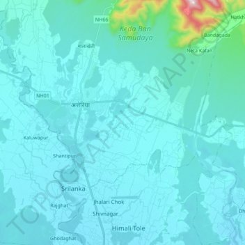
Name: Attariya topographic map, elevation, terrain.
Location: Attariya, Godawari, Kailali, Sudurpashchim Pradesh, Nepal (28.72621 80.50216 28.87506 80.66114)
Average elevation: 222 m
Minimum elevation: 176 m
Maximum elevation: 818 m
Thank you for supporting this site ❤️
Make a donation
Make a donation
Gear up for your next adventure:
As an Amazon Associate, this site earns from qualifying purchases at no extra cost to you.