
San Pedro Sula topographic map
Interactive map
Click on the map to display elevation.
About this map
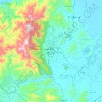
Name: San Pedro Sula topographic map, elevation, terrain.
Location: San Pedro Sula, Cortés, 21104, Honduras (15.34622 -88.18489 15.66622 -87.86489)
Average elevation: 320 m
Minimum elevation: 3 m
Maximum elevation: 1,698 m