Geolocate

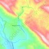
Ningerum topographic map

Click on the map to display elevation.

About this map

Name: Ningerum topographic map, elevation, terrain.

Location: Ningerum, North Fly District, Western, Southern Region, Papua New Guinea (-5.69203 141.12196 -5.65203 141.16196)

Average elevation: 73 m

Minimum elevation: 46 m

Maximum elevation: 117 m

Other topographic maps

Click on a map to view its topography, its elevation and its terrain.

Tabubil

Papua New Guinea > Western

Average elevation: 591 m

Tabubil

Papua New Guinea > Western

Average elevation: 591 m

Ok Menga

Papua New Guinea > Western > Migalsimbip

Average elevation: 574 m

Gear up for your next adventure:

🧭GPS Trackers - Tracking devices for safety and navigation
🥾Hiking Boot Waterproofing Wax - Maintain the lifespan of your leather trekking boots
🌄Outdoor Binoculars - Compact binoculars for landscape observation
🔋Power Banks - Portable chargers for long outdoor trips
🦟Anti-Midge & Tick Repellent - Vital for hiking in the Scottish Highlands during summer

As an Amazon Associate, this site earns from qualifying purchases at no extra cost to you.