
Gamvik topographic map
Click on the map to display elevation.
About this map
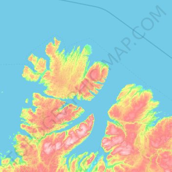
Name: Gamvik topographic map, elevation, terrain.
Location: Gamvik, Finnmark, Norway (70.39948 27.35150 71.32965 29.16078)
Average elevation: 116 m
Minimum elevation: -2 m
Maximum elevation: 709 m
Other topographic maps
Click on a map to view its topography, its elevation and its terrain.