
Thank you for supporting this site ❤️
Make a donation
Make a donation
Gear up for your next adventure:
As an Amazon Associate, this site earns from qualifying purchases at no extra cost to you.
Sakar topographic map
Click on the map to display elevation.
Thank you for supporting this site ❤️
Make a donation
Make a donation
Gear up for your next adventure:
As an Amazon Associate, this site earns from qualifying purchases at no extra cost to you.
About this map
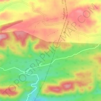
Name: Sakar topographic map, elevation, terrain.
Location: Sakar, Jhiranya Tahsil, Khargone, Madhya Pradesh, India (21.39576 75.97404 21.41791 76.00815)
Average elevation: 536 m
Minimum elevation: 427 m
Maximum elevation: 630 m
Thank you for supporting this site ❤️
Make a donation
Make a donation
Gear up for your next adventure:
As an Amazon Associate, this site earns from qualifying purchases at no extra cost to you.