Geolocate

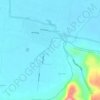
Kebonalas topographic map

Click on the map to display elevation.

About this map

Name: Kebonalas topographic map, elevation, terrain.

Location: Kebonalas, Klaten, Central Java, Java, 57485, Indonesia (-7.70817 110.46954 -7.66817 110.50954)

Average elevation: 298 m

Minimum elevation: 225 m

Maximum elevation: 391 m

Other topographic maps

Click on a map to view its topography, its elevation and its terrain.

Sanggrahan

Indonesia > Central Java > Klaten

Average elevation: 150 m

Sungai

Indonesia > Central Java > Klaten > Nanggulan

Average elevation: 113 m

Gear up for your next adventure:

🪓Outdoor Multitools - Versatile tools for hiking and camping
🧺Ultralight Dry Bags - Organize and waterproof your gear inside your rucksack
🔋Rechargeable Batteries - Eco-friendly power for headlamps and older GPS units
👖Hiking Trousers - Durable trousers designed for rough terrain
🐕Dog Hiking Gear - Equipment for hiking safely with dogs

As an Amazon Associate, this site earns from qualifying purchases at no extra cost to you.