
Thank you for supporting this site ❤️
Make a donation
Make a donation
Gear up for your next adventure:
As an Amazon Associate, this site earns from qualifying purchases at no extra cost to you.
Oiba topographic map
Click on the map to display elevation.
Thank you for supporting this site ❤️
Make a donation
Make a donation
Gear up for your next adventure:
As an Amazon Associate, this site earns from qualifying purchases at no extra cost to you.
About this map
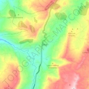
Name: Oiba topographic map, elevation, terrain.
Location: Oiba, Comunera, Santander, RAP Gran Santander, Colombia (6.22420 -73.33878 6.30420 -73.25878)
Average elevation: 1,569 m
Minimum elevation: 1,275 m
Maximum elevation: 1,937 m
Thank you for supporting this site ❤️
Make a donation
Make a donation
Gear up for your next adventure:
As an Amazon Associate, this site earns from qualifying purchases at no extra cost to you.