
Thank you for supporting this site ❤️
Make a donation
Make a donation
Gear up for your next adventure:
As an Amazon Associate, this site earns from qualifying purchases at no extra cost to you.
Olcio topographic map
Click on the map to display elevation.
Thank you for supporting this site ❤️
Make a donation
Make a donation
Gear up for your next adventure:
As an Amazon Associate, this site earns from qualifying purchases at no extra cost to you.
About this map
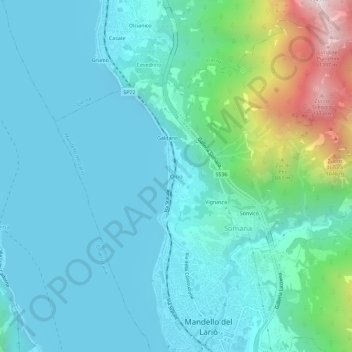
Name: Olcio topographic map, elevation, terrain.
Location: Olcio, Mandello del Lario, Lecco, Lombardy, 23826, Italy (45.91629 9.29406 45.95629 9.33406)
Average elevation: 413 m
Minimum elevation: 188 m
Maximum elevation: 1,439 m
Thank you for supporting this site ❤️
Make a donation
Make a donation
Gear up for your next adventure:
As an Amazon Associate, this site earns from qualifying purchases at no extra cost to you.