Geolocate

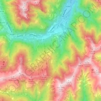
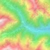
Scopello topographic map

Click on the map to display elevation.

Scopello

Scopello is a comune (municipality) located in the Valsesia region of the Italian Pennine Alps, administratively in the Province of Vercelli, Piedmont. The municipality covers an area of 18.62 square kilometres (7.19 sq mi) and ranges in elevation from 640 to 1,930 metres (2,100 to 6,330 ft) above sea level. It takes its name from its main centre, the small town of Scopello, which stands on the river Sesia at an elevation of 659 metres (2,162 ft).

Wikipedia (CC-BY-SA 3.0)

About this map

Name: Scopello topographic map, elevation, terrain.

Location: Scopello, Vercelli, Piedmont, 13028, Italy (45.71875 8.05898 45.79749 8.14081)

Average elevation: 1,256 m

Minimum elevation: 595 m

Maximum elevation: 1,935 m

Other topographic maps

Click on a map to view its topography, its elevation and its terrain.

Alpe Tele di Sotto

Italy > Piedmont > Vercelli > Cervatto

Average elevation: 1,541 m

Foresto

Italy > Piedmont > Vercelli > Borgosesia

Average elevation: 647 m

Sasso Lungo

Italy > Piedmont > Vercelli > Scopa > Otra

Average elevation: 854 m

Ruse

Italy > Piedmont > Vercelli > Varallo > I Prati

Average elevation: 787 m

Fontana dello Zolfo

Italy > Piedmont > Vercelli > Trino

Average elevation: 149 m

San Giuseppe

Italy > Piedmont > Vercelli

Average elevation: 1,618 m

Sn2

Italy > Piedmont > Vercelli > Boccioleto

Average elevation: 1,290 m

Le Castelle

Italy > Piedmont > Vercelli > Gattinara

Average elevation: 314 m

Gear up for your next adventure:

🧢Thermal Beanie Hats - Prevent heat loss from the head in windy summit conditions
📍Handheld GPS Navigators - Reliable satellite navigation for hiking and off-road exploration
🍳Camping Stoves - Compact stoves for outdoor cooking
📻Hand-Crank Emergency Radios - Stay updated on weather warnings in remote areas
🥾Trekking Poles - Poles to improve stability on uneven terrain

As an Amazon Associate, this site earns from qualifying purchases at no extra cost to you.