
Huskvarna topographic map
Interactive map
Click on the map to display elevation.
About this map
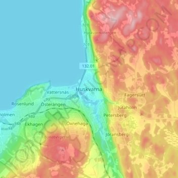
Name: Huskvarna topographic map, elevation, terrain.
Location: Huskvarna, Jönköpings kommun, Jönköping County, 561 34, Sweden (57.75187 14.23393 57.83187 14.31393)
Average elevation: 179 m
Minimum elevation: 87 m
Maximum elevation: 327 m
Other topographic maps
Click on a map to view its topography, its elevation and its terrain.